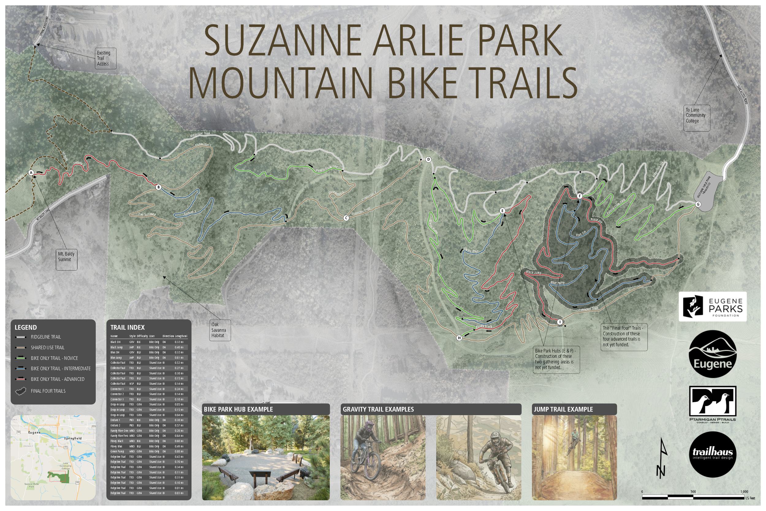
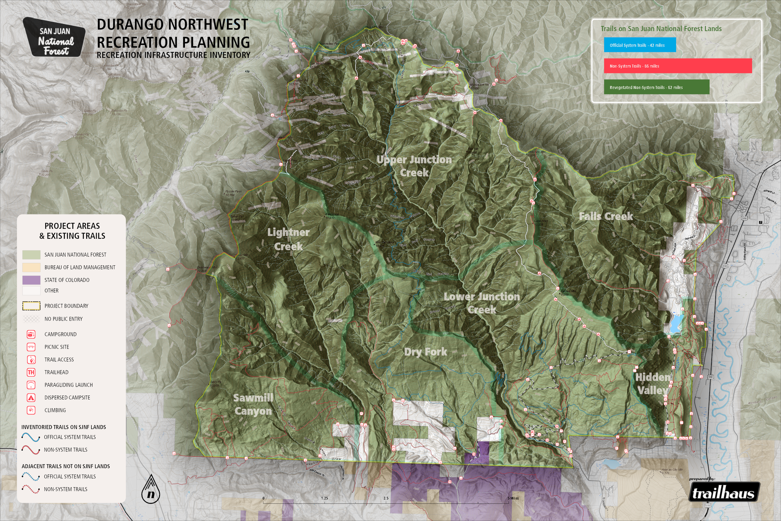
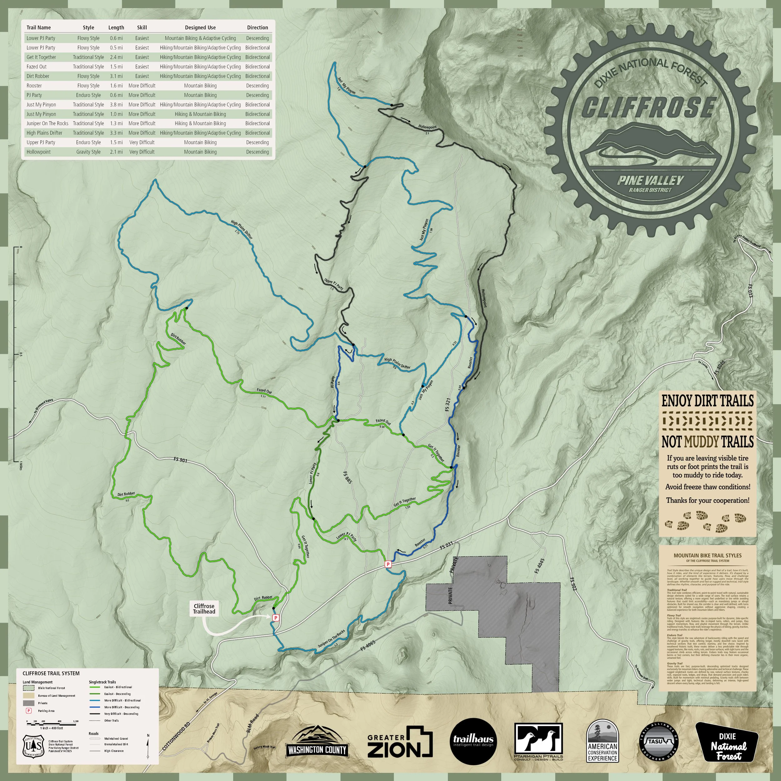
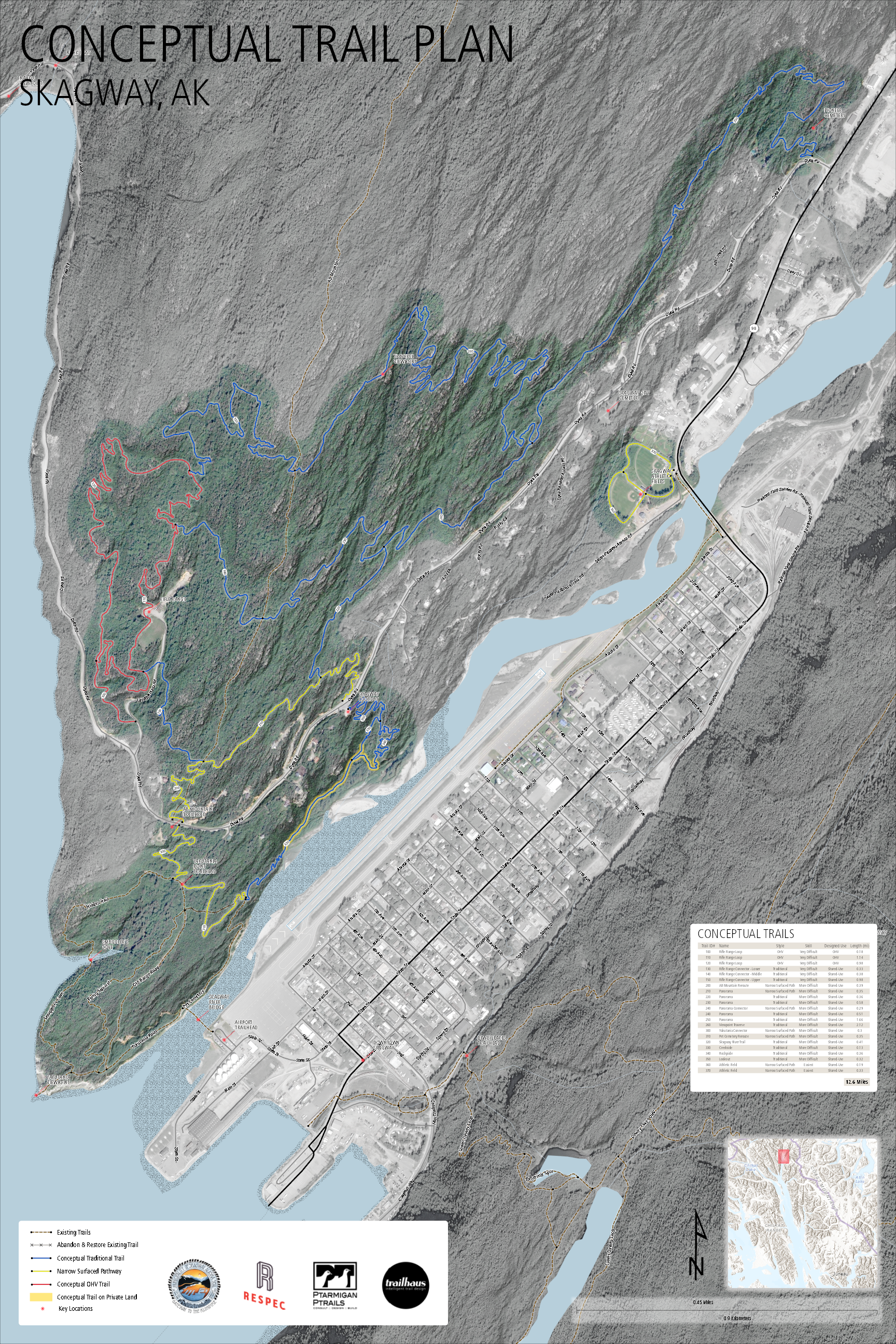
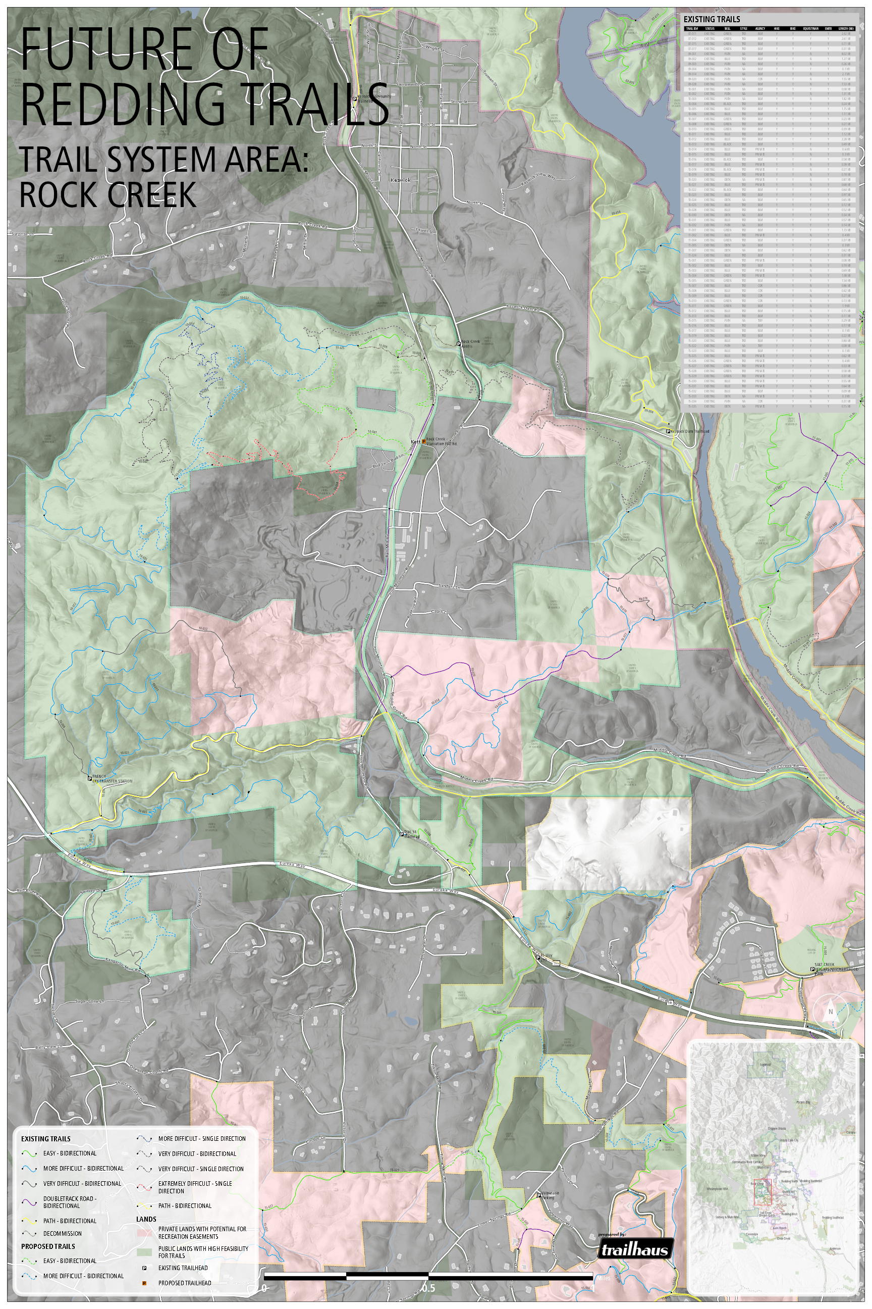
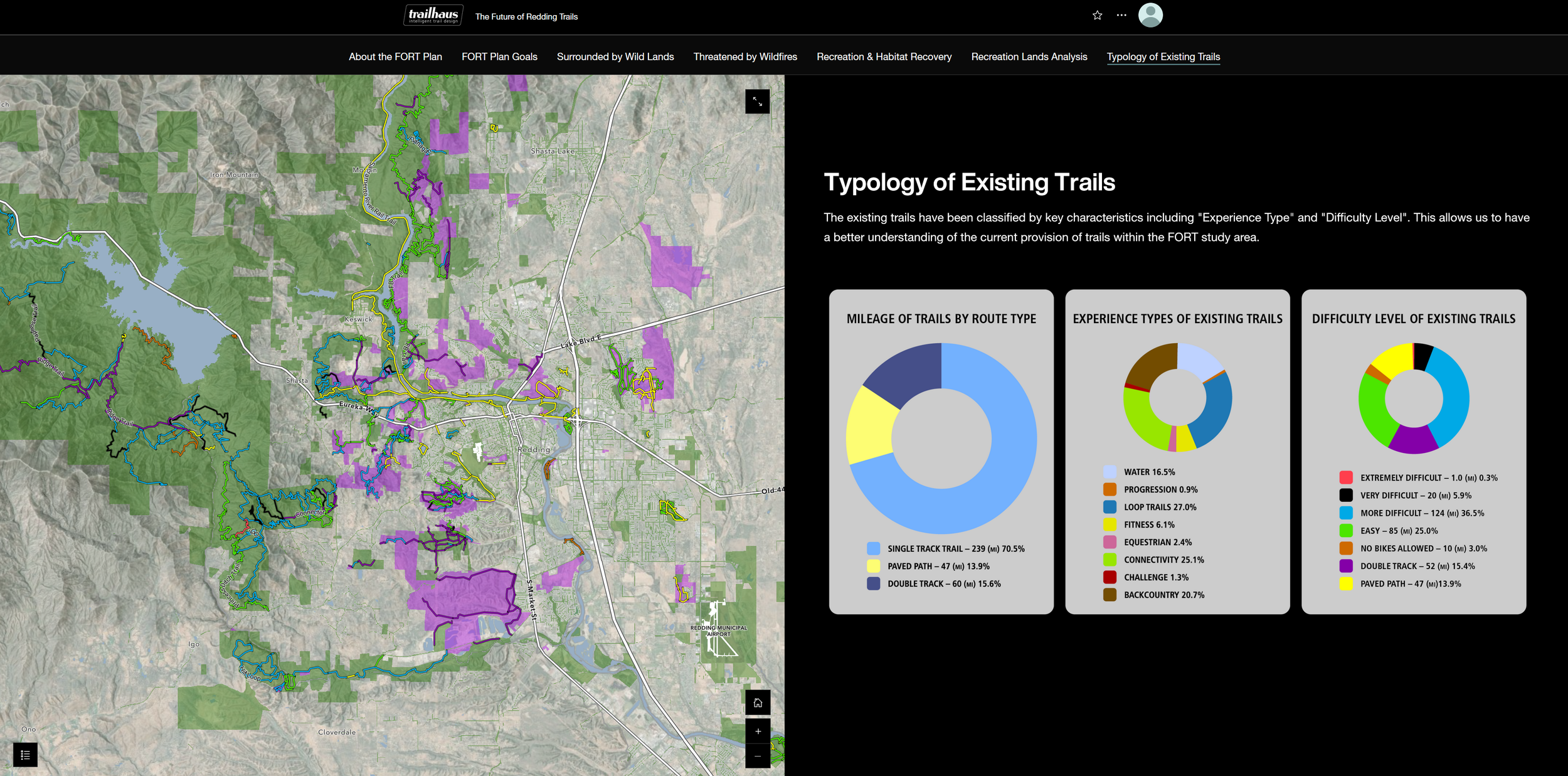
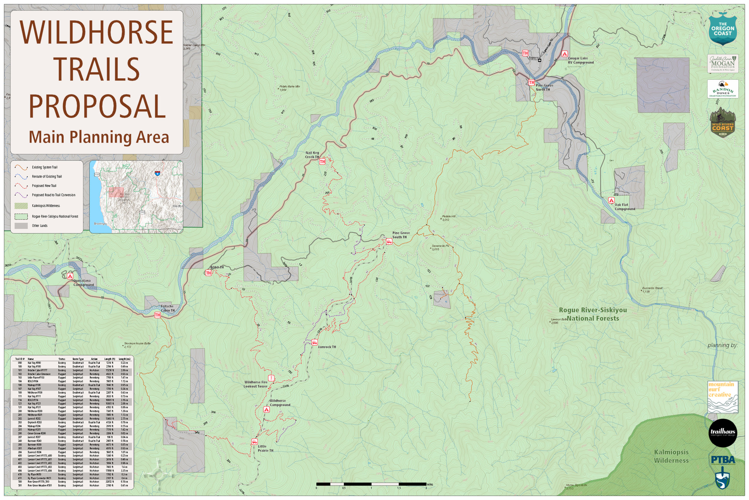
GEOSPATIAL ANALYSIS AND CARTOGRAPHY
Trailhaus uses GIS not only as an analytical tool, but as a means of communication. Our cartographic-quality maps translate complex planning data into clear, accessible visuals that support collaboration, public engagement, and informed decision-making across trail planning and project development.